

Historical County Atlases and Plat Books
Historical county atlases and plat books are bound volumes that include detailed maps of each township within a particular county. They contain maps of villages, cities, and county townships; a patron directory (those who contributed to the creation of the book); a reference business directory, illustrations, biographies, and a history of the county. They show property boundaries and land ownership for every parcel of land within a county. Besides physical features like rivers, roads, and hills, these maps showed schools, cemeteries, churches, railways, roads, and administrative boundaries. Each region had unique features; for example, some Wisconsin county atlases show locations of cheese factories. Physical features might offer reasons why residents chose to settle in a certain place. Since these books display property lines and owners as well as biographical information on some citizens, they can be extremely valuable to genealogists.
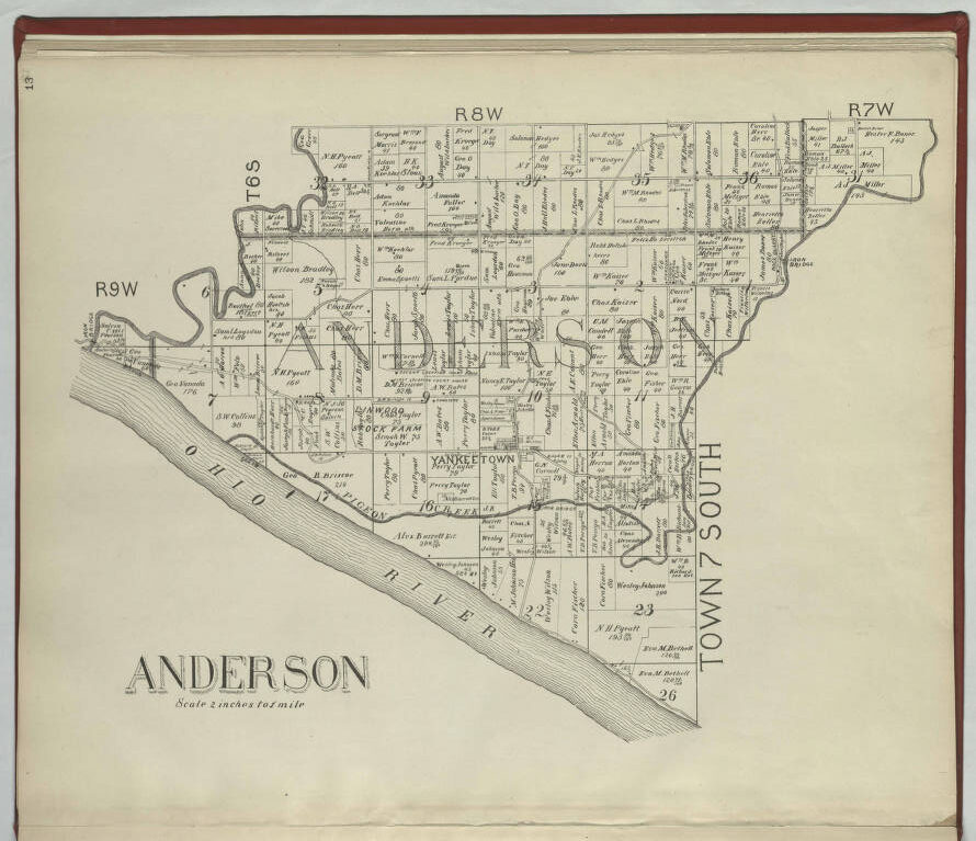
County atlases and plat books contain cadastral maps. Cadastral maps show the land’s extent, value, and ownership, especially for taxation. They were initially the most common way of displaying cadastral information about a county. They began as wall maps, usually five to six feet square. The cadastral map was drawn to scale, showing the divisions of a piece of land. US General Land Office surveyors drafted township plats of Public Lands Surveys to show the distance and bearing between section corners, sometimes including topographic or vegetation information. City, town, or village plats show subdivisions broken into blocks with streets and alleys. Further refinement often splits blocks into individual lots, usually for the purpose of selling the described lots; this has become known as subdivision. See Figure 2 for an example of a cadastral map of Anderson Township, Warrick Co., Indiana.
History
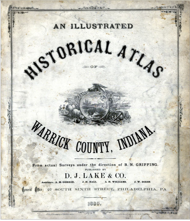
Because they contained a variety and quantity of information (insets of town plans, building illustrations, etc.) these maps were unwieldy and challenging to store. Their large size and the publishers’ desire to present even more information resulted in the development of the sheet atlas. The first county atlases were published in 1864 (Figure 1) and soon became the preferred means for presenting cadastral information. They were popular from the 1800s to the early 1900s and were originally used as a marketing tool for selling books. They became popular around the time in American history when smaller towns were beginning to flourish and were also a way to list achievements for local farmers.
A Glimpse of Local History
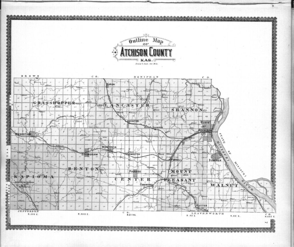
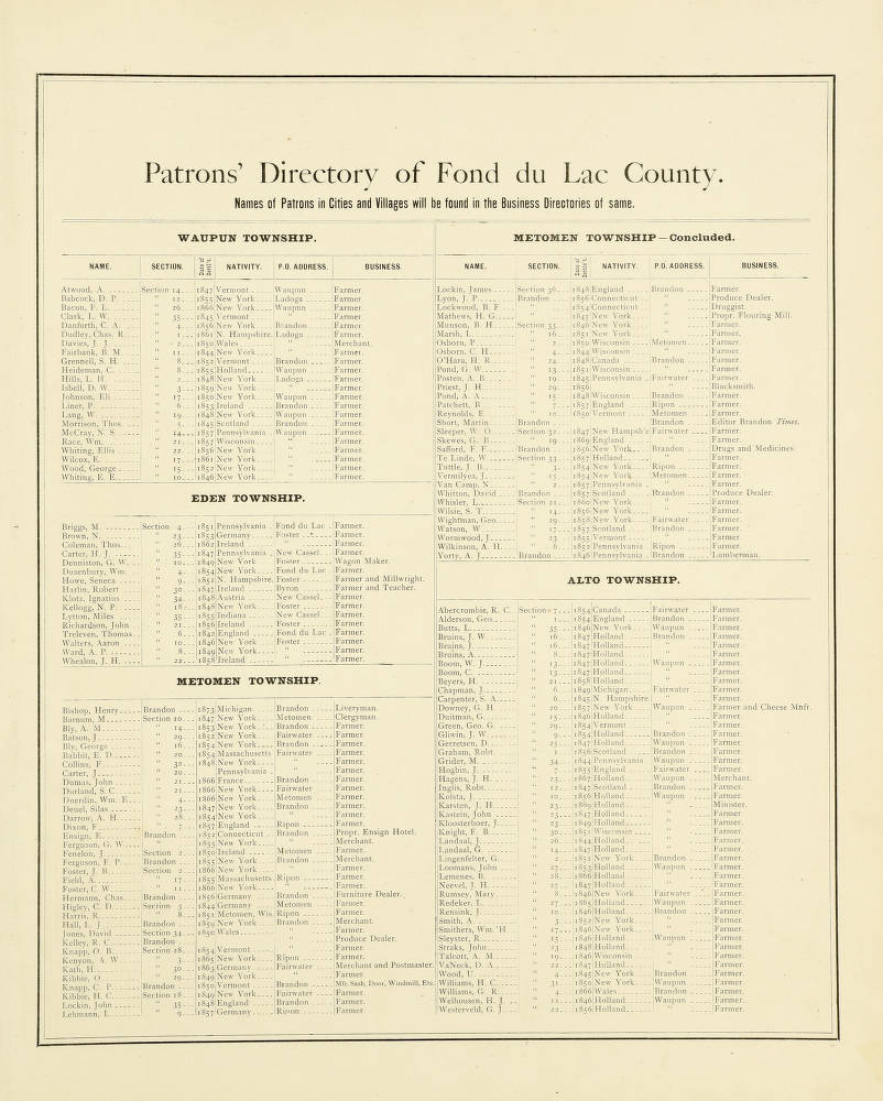
The atlas included a county map, state map, and other land owner maps. Outline maps included much cadastral information but without names of landowners (Figure 3). Salesmen would go door to door, first to the more prominent citizens, and sell them as pre-orders for around ten dollars. For additional fees, these citizens could also have their portraits included, as well as a professional drawing of their homesteads. They were listed as patrons (Figure 4). For many families, the county atlas was the first time they had a glimpse of what the rest of their county looked like.
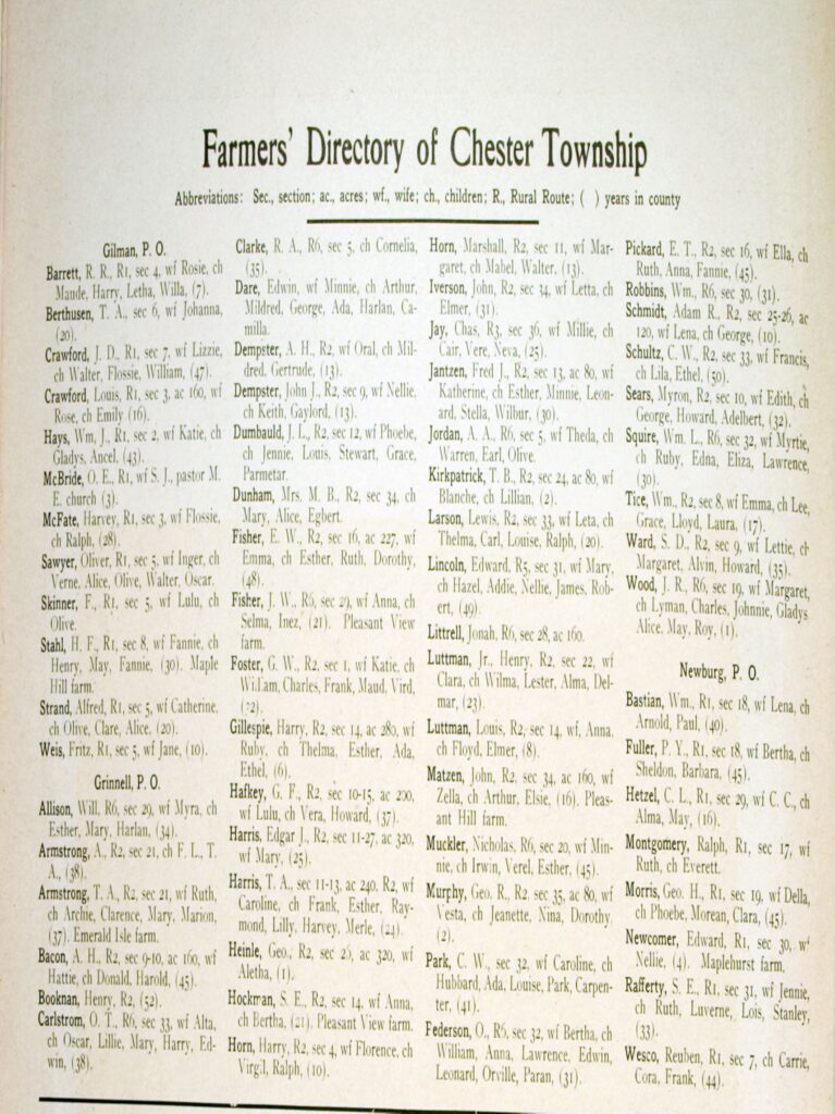
The land owner map that was included in these atlases has become an excellent source of information when researching family genealogy. However, in some historical atlases, farm directories may be included. Figure 5 shows an example of a farm directory page from a Poweshiek Co., Iowa township that provides valuable genealogical information about some of the township’s families.
Genealogical Value
What began as a marketing venture has given genealogists a vast resource of historical information about small American towns. The atlas map contains valuable information about the families that founded many of these towns around America. Additionally, several historical organizations have been able to use land atlas information to determine the original sites of historic structures that they could not determine by any other means.
A great number of these atlases have been put into general digital databases free of charge, such as the Internet Archive, Google Books, HathiTrust Digital Library, and Historic Map Works: Residential Genealogy. Historic Map Works charges for image purchases, but allows viewers to look at them at no cost.
Here are some state-specific collections of digitized county atlases you can check out:
- Delaware – http://www.historicmapworks.com/Atlas/US/751/
- Indiana – https://ulib.iupui.edu/digitalcollections/HistAtlas
- Iowa – https://digital.lib.uiowa.edu/atlases
- Kansas – https://www.kansasmemory.org/category/11782 and https://www.kshs.org/p/property-ownership-maps-or-plat-books/13859
- Michigan – https://quod.lib.umich.edu/m/micounty/cginame=text-idx;id=navbarbrowselink;page=browse
- Minnesota – https://www.lib.uminn.edu/collections/borchert/digitized-plat-maps-and-atlases
- Missouri – https://digital.shsmo.org/digital/collection/plat
- New York – https://tinyurl.com/msb7bnf5
- North Dakota – http://digitalhorizonsonline.org/digital/collection/p16921coll2
- Ohio – https://www.ohiohistory.org/preserving-ohio/state-historic-preservation-office/historic-atlases/
- Pennsylvania – http://www.phmc.state.pa.us/bah/dam/mg/di/m011/CountyMapsInterface.htm
- Wisconsin – https://search.library.wisc.edu/search/digital?q=county+atlas
If you’re fortunate to find your family in a county historical atlas, take full advantage of its contents. Good luck with your research!


Recent Comments