Ancestors and the Weather
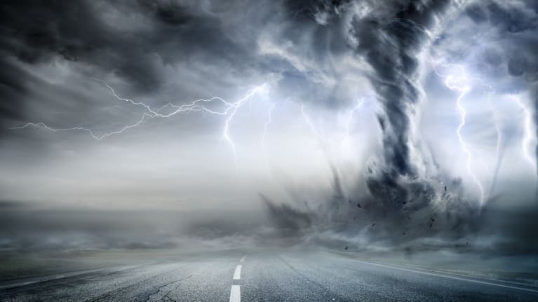
You may ask, “What does weather have to do with genealogical research?” The answer is, “A lot,” especially when you start asking yourself questions such as: Where did my ancestors go? When did they move? Why did they move there? The answers might have had something to do with the weather.
Brief History of Historical US Weather Data
Diverse resources exist for climatological research that can add dimension and understanding to your family history. Unfortunately, historical weather data does not exist for every locale in the US. The National Archives holds records for hundreds of observatories concerned with recording scientific data about the weather, but they are not online.
The federal government began taking an interest in the weather in 1818 when it directed employees of the Office of the Surgeon General to keep diaries on the weather. In 1870, responsibility of recording weather data was transferred to the Office of the Chief Signal Officer. It wasn’t until 1890 that the government designated a specific office for these types of observations when they established the first federal Weather Bureau under the Department of Agriculture, which has since existed in various forms.
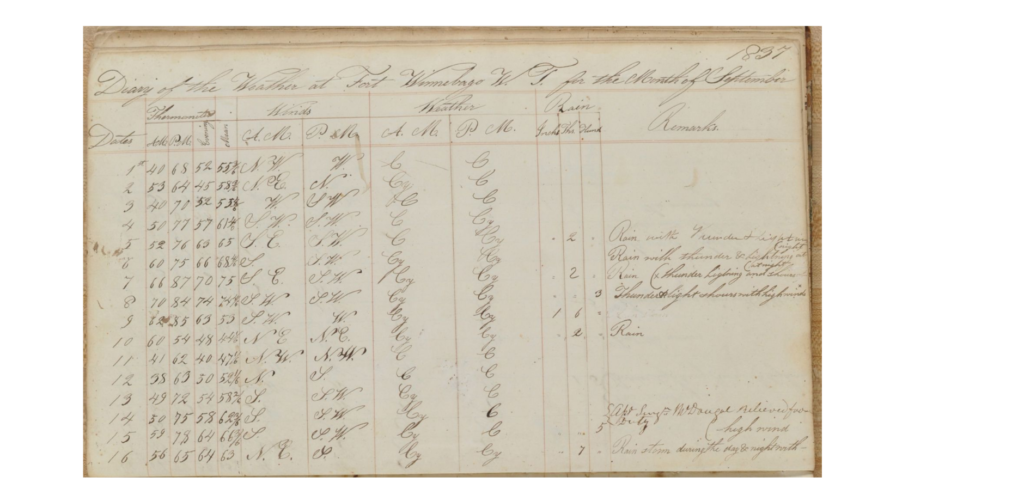
Weather: An Overlooked Aspect of Genealogy
When collecting information on where and how your ancestors lived, a most important element to consider including is the weather. Climate and weather conditions your ancestors experienced can make a big difference in how and where they lived. For rural ancestors, weather very much dictated when and where life events occurred and were recorded. Weather events can (and should) be integrated into family history research. It’s important to include social history when telling your family stories, but very early weather data can be sparse, difficult to find, and may not be worth research effort. Still, depending on the resources available, you may be able to get a good idea of the weather conditions under which your ancestors lived.
Weather’s Effects on Families
Weather could and did have profound effects on ancestral lives, economically, socially, and geographically. For example, hurricanes could cost a fisherman his livelihood and cause him to move in with family elsewhere to find other work. Bad rainstorms could generate floodwaters that washed out bridges, causing a couple to marry in a courthouse in a neighboring county. Bad droughts could mean an out-of-work farmer moved his family to a city in his current state or further out.
What Else Can Historical Weather Research Do for Genealogists?
Historical weather research can also aid with investigating family photographs. This means paying attention to the weather and the date of photo if it was taken outside. The fact that there is snow on the ground when the family lived in a mild climate could narrow the possible dates a photo was taken. Shadows present in an outdoor photograph can indicate the exact location and even exact time of day it was taken.
Warfare and Weather during the American Revolution
Weather conditions have had profound effects on the performance of armies during battles. Genealogically speaking, we can also see how weather conditions affected individual soldiers through their diaries, journals, letters, and pension applications. Including these accounts greatly enhances family narratives. Revolutionary War pension applications are digitally available on the Fold3.com subscription database in the Genealogy Room. A great number of them have been faithfully transcribed and are freely accessible at http://www.revwarapps.org (Southern Campaigns Revolutionary War Pension Statements & Rosters). An archived sample list of some soldier diaries is available on the Internet Archive. Diaries and journals may or may not be digitized.
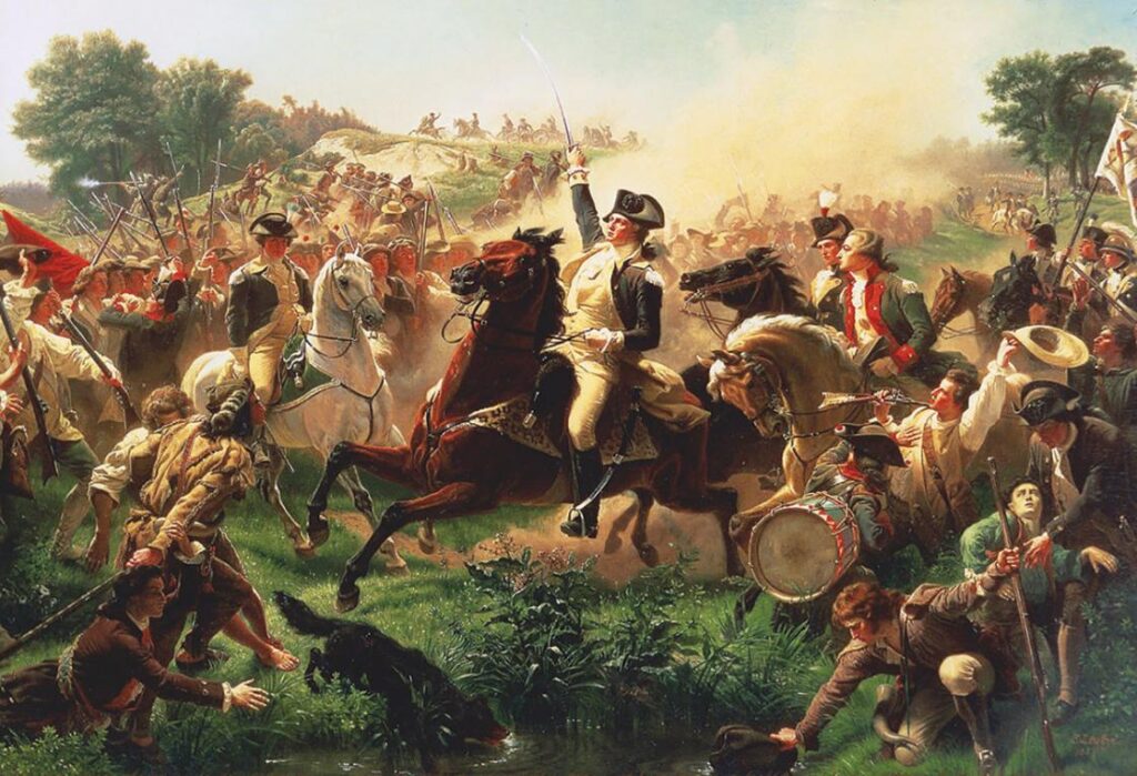
American painter Emanuel Leutze.
At the Battle of Monmouth, New Jersey, June 28, 1778, heat and humidity raised temperatures to more or less 100 degrees. Heat stroke can occur when body temperature reaches 104 degrees. John M. Roseberry stated in his pension application that “[at] the time this battle was fought the weather was very warm and the day on which the engagement took place was a very sultry one and Deponent states it as a matter personally known to himself that much of the American Army died through the excess of heat and want of water.” George Dowell “well recollects that it was one of the hottest days he ever felt and that many died with over heat as was then said and believed by him. At any rate he saw a number dead who appeared to have died in consequence of the heat, & (perhaps) in part of fatigue.” It is clear that the high temperatures made battle conditions of battle that much harder.
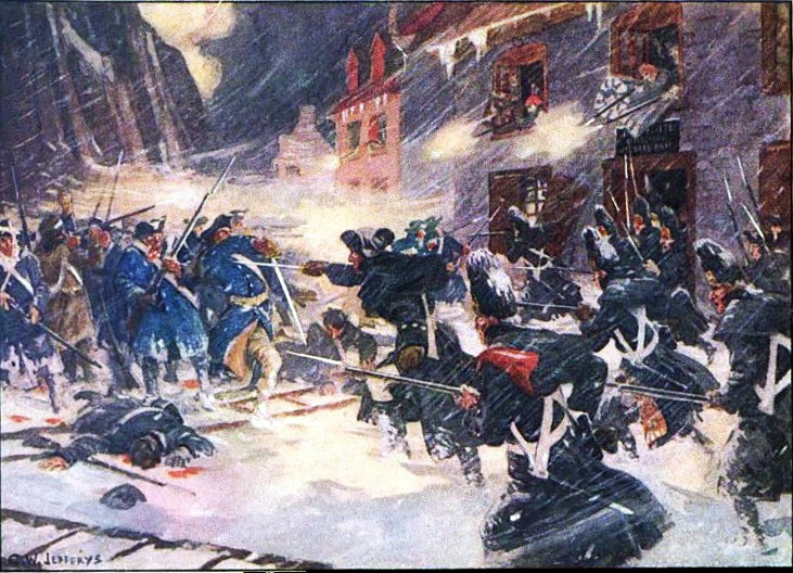
Matelot, December 31, 1775 by Charles William Jefferys.
At the opposite end of the thermometer, many soldiers spoke of their experiences fighting in winter storms in Quebec in 1775, Trenton in 1776, Valley Forge in 1777-1778, and Morristown in 1780-1781. Men who marched with Benedict Arnold through the Maine wilderness to Quebec experienced a hurricane as well as freezing weather. On the march to Quebec, Henry Dearborn wrote in his diary that “Capt Goodrich was almost perished with the Cold, having Waded Several Miles Backwards, and forwards, Sometimes to his Arm-pits in Water & Ice;, endeavouring to find some place to Cross this River.” John Boudy stated “That on Christmas night of this year, we crossed the Delaware River some miles above Trenton, it was snowing at this time and the night was unusually stormy. Several of our men froze to death.” Of Valley Forge, George Godby recollected that he “marched through cold & wet & sometimes Snow more than twenty inches deep, with but few of the comforts & but a scanty allowance of the necessaries of life.” Richard Price recalled that he “marched to Valley Forge, and went into winter quarters, which march he was barefooted and it was raining and snowing.” Stephen Howard had “to march to Morristown in New Jersey for Win[ter] quarters which we effected altho almost destitute of shoes & clothing through bad roa[ds] & deep snows.”
“Eighteen Hundred and Froze to Death” and Other Traumatic Weather
One of the most dramatic weather conditions resulted when Mt. Tambora, a volcano in Sumbawa, Indonesia, erupted between April 7 and April 12, 1815. It was the largest volcanic eruption recorded by humans. Tens of thousands of people died. The sound of the eruption was heard 1,000 miles away. Ashes and cinders created darkness for three days for hundreds of miles around volcano, and winds carried ashes and cinders around earth.
The combination of increased sunspot activity, heightened volcanic activity, and cooler water temperatures (ice on the Great Lakes and in the Atlantic Ocean) resulted in an agricultural disaster, especially in New England and northern Europe. According to the US National Park Service:
May frost killed off most of the crops in New York, Massachusetts, New Hampshire, and Vermont. In June, heavy snow smothered the ground in Albany, New York and Dennysville, Maine, while frost persisted for five consecutive nights in Cape May, New Jersey. The relentless cold weather extended into late summer, in what would have normally been harvest season. In July, lakes and rivers remained frozen as far south as northwestern Pennsylvania, while frost remained in Virginia into late August. Temperatures dipped from above-normal summer temperatures to near-freezing within mere hours.
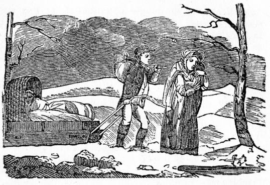
summertime. Bowdoin College.
Sarah Snell Bryant, of Cummington, Massachusetts, wrote in her diary, “Weather backward.”
Winter chills from 1812-1815, 1816’s ruinous harvest, and the end of the War of 1812 caused “Ohio fever” among hungry and financially devastated farmers in New England, and thousands of them began migrating westward. One group of fleeing Mainers founded the village of Maineville in southwest Ohio in 1815. If your early nineteenth-century New England ancestor relocated to the west, weather might have been the reason. This weather phenomenon became known as “Eighteen hundred and froze to death,” “The Poverty Year,” and the “Year Without Summer.” Both were phrases commonly used (and are still used) to describe the climatological havoc wrought by Mt. Tambora’s eruption.
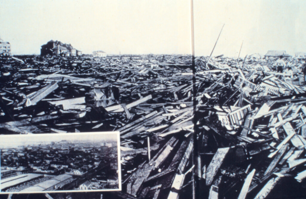
If you had relatives in Southeast Texas at the turn of the twentieth century, genealogical resources pertaining to the Galveston Hurricane of September 8, 1900 are available at the Galveston History Center. This storm is the nation’s deadliest natural disaster. Although its death toll will never be known precisely, it claimed over 8,000 lives on Galveston Island and several thousand more on the mainland. In Galveston, it destroyed 2,636 houses and left thousands more damaged. The city’s property losses were estimated at $28-30 million.
The Center’s resources include the Archives and Museum online catalogs, which can be accessed from the Center (Archives) and The Rosenberg Library (Museum). The Archives includes digitized versions of most photos, Storm of 1900 materials, research guides, and finding aids to the archival collections. The Museum catalog contains images of all museum items. You can also access the digitized The Galveston Daily News there, or on the NewspaperArchive database in the Grapevine Library Genealogy Room. City directories from 1859-1925 and much of the Galveston Tribune are freely accessible on the Portal to Texas History.
The Dust Bowl of the 1930s also led to mass migrations westward. This phenomenon was caused by a combination of both natural factors (severe drought) and man-made factors. Drought came in three waves: 1934, 1936, and 1939-1940, but some regions of the High Plains experienced drought conditions for as many as eight years. Choking billows of dust – named “black blizzards” or “black rollers” – traveled cross country, reaching as far as the East Coast and striking such cities as New York City and Washington, DC. On the plains, they often reduced visibility to three feet or less. It affected 100 million acres that centered on the Texas and Oklahoma Panhandles and touched adjacent sections of New Mexico, Colorado, and Kansas, causing mass migration toward the West Coast and the appearance of migrant camps.
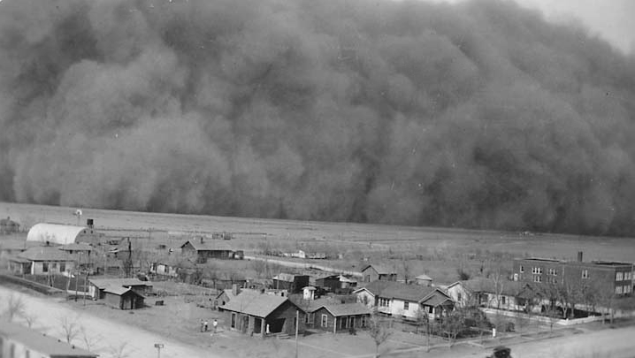
Digital Archives.
If you had relatives in Oklahoma at this time, check out Dust Bowl Days: the Oklahoma-California Genealogy Connection for some helpful resources. The 1940 federal census can help you learn where relatives settled after leaving the Dust Bowl states and may also give a clue as to when they left because this census asks where people were living in 1935. Another census item is worth considering as well – the “Occupation” column. Many migrants continued performing farm work of some kind.
Additional genealogical sources of weather-related information include burial reports, which may contain outbreaks of cholera and dysentery, or “summer disease” or “winter fever” that are affected by weather. County histories usually include descriptions of climate and weather conditions affecting their locations. Many shipwrecks can also be attributed to storms on the high seas. Even homestead records can provide clues; they may show waivers of deadlines for land improvement that were granted to a homesteader who could not work his land due to severe weather.
Be sure to check out the following web sites for on-line historical weather information and consider how you could creatively weave it into your family’s story.
National Oceanic Atmospheric Administration – Weather and Climate Resources – Historic
Weather Underground – Historical weather 1930-present.
Monthly Reports of the Department of Agriculture (Google Books)
US Department of Agriculture, Weather Bureau. Climatological Data series
Weatherforyou – Enter a date from the past and it will display significant historical weather events from various locations across the US.
Weather History Archive – Access weather history data back to 1945 by entering city, state, or ZIP code.




Recent Comments